Virtual Geographical Environment
There are two projects about the virtual geographical environments and its applications in geography.
1 The Virtual 3D model of Fuzhou Strait Olympic Sports Center
The National Winning Award on 2015 EsriCup National Collegiate Developed Contest in GIS·3D Modeling and Design.
Co-author: Minhang Ye, Ruitong Cheng, Haihan Zhuo
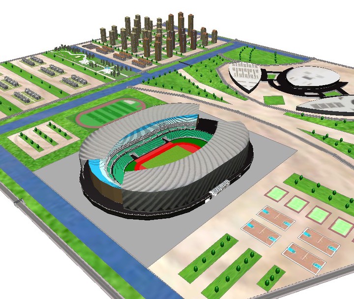
The research built up the virtual 3D model of Fuzhou strait olmpic sports center. At the same time, our research includes the planning of the surrounding infrastructure. Eespecially, we use City Engine to construct our variable model(different styles of building) to create greater values.
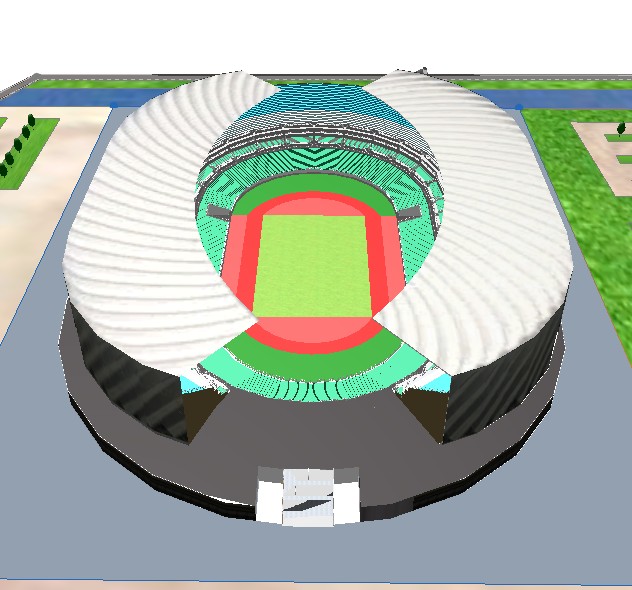
Figure 1. Scene 1 of 3D model of Stadium

Figure 2. Scene 2 of 3D model of Stadium

Figure 3. Scene 3 of 3D model of Stadium

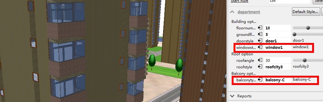
Figure 4. Different styles of buildings
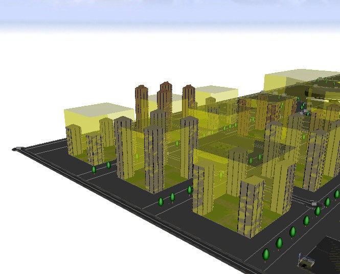
Figure 5. Detection of illegal construction
2 The Planning Location and Design of Smart Campus Based on BIM and GIS:A Case Study of Fujian Normal University
This is my undergraduate thesis. With the tide of Smart City and Big Data era, I explore the practice of Data Augmented Design, GIS and BIM in Smart Campus’s Application based on Fujian Normal University Keji Buildings.
With the tide of Smart City and Big Data era, I explore the practice of Data Augmented Design, GIS and BIM in Smart Campus’s Application based on Fujian Normal University Keji Buildings. I build the simulation model of building site location and construction. And I use Data Augmented Design, GIS spatial analysis, Space Syntax and City Engine 3D modeling to support the building site location and assessment of planning, build the BIM model and develop the public participation GIS of Keji Buildings. This work was funded by the Project-The Technological Innovation Plan of University Students, Fujian Normal University, “The Optimization Model of High Education Staff’s Refuge Space Under Earthquake Disater”(cxxl-2014137).

Figure 6. Public Participant GIS